Michael Collins’ Birthplace to be delisted from Record of Monuments

Gallery

This gallery contains 3 photos.

One of the anomalies surrounding the proposal by the Department of Arts, Heritage and the Gaeltacht to delist post-1700 monuments from the statutory Record of Monuments and Places is that some of the monuments indicated for delisting are National Monuments … Continue reading

New Irish environmental regulations require more land restructuring and water management projects be scoped and assessed.

A ringfort forms part of a field boundary near Cam, Co. Roscommon.

The Irish Government has unveiled its approach to amending the Environmental Impact Assessment system to comply with the European Court of Justice ruling C-66/06. The new regulations will require more land restructuring and water management projects be scoped and environmentally assessed.

 The European Court judgement

In November 2008 the European Court of Justice in the case of the European Commission versus the Republic of Ireland (ECJ C-66/06) ruled that Ireland had not adopted all measures to ensure that projects likely to have significant effects on the environment that belong to categories 1a (projects for the restructuring of rural land holdings), b (projects for the use of uncultivated land or semi-natural areas for intensive agricultural purposes); and c (water management projects for agriculture, including irrigation and land drainage projects) of Annex II of Environmental Impact Directive 85/337/EEC (amended by Directive 97/11/EC) were assessed for environmental impacts before consent was given. See the full judgement here .

The court ruled that by setting thresholds which take account only of the size of projects – to the exclusion of the other criteria laid down in Annex III to Directive 85/337 such as:

  • project characteristics,
  • project size,
  • cumulative impacts,
  • the use of natural resources,
  • waste production,
  • pollution,
  • nuisance,
  • risk of accident,
  • project location, and
  • characteristics of potential impacts;

and by not providing for project screening, Ireland had exceeded the limits of its discretion under Articles 2(1) and 4(2) of the Directive and had consequently not adopted all necessary measures to ensure that projects likely to have significant effects on the environment are made subject to a requirement for development consent and to an assessment of their environmental effects in accordance with Articles 5 to 10 of the Directive.

The court also noted that the Irish EIA thresholds of 100 ha in relation to the restructuring of rural holdings and 20ha in relation to water management projects in wetlands were so large that projects below these thresholds with significant environmental impacts would be granted consent without having been subject to Environmental Impact Assessment.

Significance for cultural heritage

The significance of this for cultural heritage is that the European Court noted that Irish studies had established a risk of accelerated destruction of archaeological remains directly connected with projects for the restructuring of rural land holdings and land drainage projects. In fact Archaeological Features at Risk (O’Sullivan et al. 2001), published by the Heritage Council, had found that land improvement (the removal of field boundaries and ditches) and drainage were the overwhelming causes of loss of field monuments in Ireland. The report also found that with the increasing intensification of Irish agriculture the rate of monument loss was increasing.

The Irish Government response

In response to the judgement the Minister for the Environment and Local Government and the Minister for Agriculture, Fisheries and Food have jointly produced new regulations – the Planning and Development (Amendment) (No.2) Regulations 2011 and the European Communities (Agricultural Environmental Impact Assessment) Regulations 2011 – to bring Ireland into compliance with the principles and requirements of the Environmental Impact Assessment Directive.

The new Planning and Development (Amendment) (No.2) Regulations 2011, transfer responsibility for most of the activities covered by the ECJ C-66/06 judgment, such as the re-structuring of fields and removal of boundaries, the use of uncultivated land or semi-natural areas for intensive agriculture and normal field drainage works, to a new consent system that will operate under the aegis of the Department of Agriculture, Fisheries and Food.

The new Department of Agriculture, Fisheries and Food regulations cover the following categories of development:

  • the restructuring of farm holdings;
  • the use of uncultivated land or semi-natural areas for intensive agriculture; and
  • land drainage works on lands used for agriculture, excluding the drainage and reclamation of wetlands, and

propose a new system of screening, to be undertaken by the Department of Agriculture, for environmental impact above certain thresholds for different types of agricultural activity, and the requirement for mandatory Environmental Impact Assessment to be carried out on such projects at a higher level.

The regulations will have impose new thresholds for Environmental Impact Assessment screening and mandatory Environmental Impact Assessment that are set out below:

Category of activity Threshold for Environmental Impact Assessment screening Threshold for consent and mandatory Environmental Impact Assessment
Re-structuring of rural land holdings

  • Length of field boundary to be removed
 500 metres  4 kilometres
  • Re-contouring (within farm-holding)
2 hectares 5 hectares
  • Area of lands to be restructured by removal of field boundaries
5 hectares 50 hectares
Commencing to use uncultivated land or semi-natural areas for intensive agriculture 5 hectares 50 hectares
Land drainage works on lands used for agriculture (excluding drainage or reclamation of wetlands) 15 hectares 50 hectares


Additional considerations will also have to be given to activities that impact on certain sites such as designated Natura 2000 areas, recorded monuments, natural heritage areas and proposed natural heritage areas and other nature reserves, given their environmental and heritage sensitivities.

The only element of the Environmental Impact Assessment system touched on by the ECJ C-66/06 judgment that will be retained within the Local Authority planning system is on-farm development activity that impacts wetlands.  The Planning and Development (Amendment) (No.2) Regulations 2011 propose an exempted development threshold of 0.1 hectare.  The mandatory threshold for Environmental Impact Assessment of drainage of wetlands will be reduced from 20 hectares to 2 hectares.  Planning permission accompanied by an Environmental Impact Assessment may be required even in respect of drainage below the 0.1 threshold in cases where the drainage would have a significant effect on the environment.

Further reading

O’Sullivan. M., O’Connor, D.J. and Kennedy, L. 2001. Archaeological Features At Risk: A Survey Measuring The Recent Destruction OF Ireland’s Archaeological Heritage. The Heritage Council, Kilkenny.

Cite this post as:

Mount, C. New Irish environmental regulations require more land restructuring and water management projects be scoped and assessed. The Charles Mount Blog, September 15, 2011. http://charles-mount.ie/wp/?p=500.

The houses of the Irish Copper Age 1.1

Reconstruction of the Copper Age house from Monknewtown, Co. Meath. Illustration from Sweetman 1976.


Introduction

In Ireland the use of copper commenced sometime in the period 2600-2400 BC with the development of indigenous copper production following after 2400 BC. The Copper Age continued until 2200/2100 BC when copper was alloyed with tin to create bronze and the Early Bronze Age commenced. The Copper Age is distinguished from the preceding Late Neolithic as mining and the use of copper and gold came into use, hoards of metal objects were deposited and Grooved Ware style pottery was replaced by a new international style known as Beaker.

Identifying the houses

In comparison to other periods there is comparatively little evidence of Copper Age houses. Copper Age activity in the form of spreads of soil containing Beaker pottery and lithic material associated with stake-holes, post-holes and hearths have been found at a number of sites such as the passage tombs of Newgrange and Knowth in the Boyne Valley of Co. Meath, and at an increasing number of other sites throughout Ireland. However, in only a few instances have the excavators been able to determine with certainty the presence of actual Copper Age houses.

To date only about a dozen houses can be said to date to the Copper Age. The houses have been identified at just four sites: Lough Gur, Co. Limerick, Monknewtown, Co. Meath, Graigueshoneen, Co. Waterford and Ross Island, Co. Kerry. In the case of Lough Gur, excavated in the 1940s and 1950s, the houses are dated on the basis of association with Beaker pottery, but the remaining houses all have finds of Beaker pottery and corrobative radiocarbon dates. The Monknewtown House was dated to 2456-2138 BC, Graigueshoneen to 2460-2200 cal BC and the Ross Island houses to 2510-2150 BC.

Ross Island is the most significant site as it is an early copper mine with more than half the recognised houses of the period associated with Beaker pottery. At Lough Gur the houses were built at an established Neolithic settlement and the Circle L House succeeded three earlier Neolithic houses. The house at Graigueshoneen may also have succeeded an earlier house. The Monknewtown house was constructed in the interior of a hengiform ceremonial enclosure and was probably a ceremonial structure but is still useful for examining the architecture of the period.

The form of the houses

Most of the houses have ground plans ranging from oval to sub-circular and there are two D-shaped, and a rectangular and trapezoidal example. The houses vary in size from the largest example at Graigueshoneen, which was 7.6m in diameter, to the much smaller houses at Ross Island that measured from 5m down to just 1.2m in diameter. The construction method was variable with wooden stakes the most common method for supporting walls. The walls supported by the wooden stakes were presumably light wattle panels similar to those identified in wetland excavations. Stakes were sometimes used in conjunction with bedding trenches as at Ross island site A. A number of the houses at Graigueshoneen and Ross Island had overlapping concentric rings of stakes. This may indicate that these houses were rebuilt or they may have had inner and outer wall faces that contained an internal filling.

The houses at Lough Gur were different; they were of heavier construction with wooden posts and bedding trenches and had stone wall footings that would have supported heavier walls and roofing. In about half the houses there were post-holes that could have supported a roof but in the remaining cases it is not clear how the roofs were supported. At Monknewtown and Ross Island A and E the roof supports were internal and the houses may have resembled tents. The original reconstruction of the Monknewtown house suggests a structure like a tent with the internal posts supporting the roof and the eaves resting on the ground. Where doorways were identified these were on the northern, southern and eastern sides with no western examples.

Conclusion

The light construction and the use of wooden stakes to support probably low and light weight wattle panels and the use of a few internal posts to support the roof appears to have been the characteristic building method of the Copper Age. This would explain why so few Copper Age houses have been identified. A series of light oval structures rebuilt in the same location would leave a meaningless jumble of stake and post-holes associated with spreads of settlement material. The fact is that many of the spreads of settlement material associated with Beaker pottery and stone artefacts are probably the remains of Copper Age settlements. The really puzzling thing however is that not a single one of these definite or possible Copper Age settlements contained a scrap of copper.

Additional notes

Robert Chapple has written a very interesting blog involving an analysis of the radiocarbon dates of the Copper Age which you can read here.

Version 1.1: revised 3/10/2011

Further reading

William O’Brien’s 2004 volume Ross Island: Mining, Metal and Society in Early Ireland, Bronze Age Studies 6, NUI Galway, is the most important work produced to date on the Copper Age in Ireland and contains the excavation reports of most of the known Copper Age houses. The Lough Gur houses were published in Seán P. Ó Ríordáin 1954, Lough Gur Excavations: Neolithic and Bronze Age Houses on Knockadoon, Proceedings of the Royal Irish Academy, Section C, 297-459 and Eoin Grogan and George Eogan et al. 1987, Lough Gur Excavations by Seán P. Ó Ríordáin: Further Neolithic and Beaker Habitations on Knockadoon, Proceedings of the Royal Irish Academy, Section C, 299-506. Monknewtown is published in P. David Sweetman 1976 An Earthen Enclosure at Monknewtown, Slane, Co. Meath, Proceedings of the Royal Irish Academy, Section C, 25-73. Graigueshoneen is published in John Tierney et al. 2008, Beaker Settlement: Area 2, Graigueshoneen TD Licence No. 98E0575, in P. Johnston et al. Near the Bend in the River: The Archaeology of the N25 Kilmacthomas Realignment. NRA Scheme Monographs 3, Dublin.

About the author

Dr. Charles Mount has been involved in research on the Irish Bronze Age for more than twenty years and has published extensively on the burials, monuments and artefacts of the period. This blog post is based on research he is preparing for a book on the period. You can read more of Dr. Mount’s publications here .

Cite this post as:

Mount, C. The Houses of the Irish Copper Age. The Charles Mount Blog, September 8, 2011. http://charles-mount.ie/wp/?p=484

The Journal of Irish Archaeology Volume XIX 2010: Review


One of the highlights of the archaeological year is the publication of the Journal of Irish Archaeology by the Institute of Archaeologists of Ireland. This latest volume XIX for 2010 is edited by Prof. James Mallory of Queen’s University Belfast and includes six papers on a variety of topics ranging from prehistory to the post-medieval period. There are papers on the rock art of Loughcrew and George Petrie’s work on megalithic tombs. There are surveys of Inis Airc Island, medieval church altars and the limestone quarries of the Hook Peninsula, and there is also a report on the excavation of early medieval and prehistoric features at Ballyburn Upper, Co. Kildare.

Open-air rock art at Loughcrew, Co. Meath

Elizabeth Shee Twohig, Corinne Roughley, Colin Shell, Ciaran O’Reilly, Peter Clarke and Gillian Swanton

Elizabeth SheeTwohig et al. report on 10 new examples of rock art found in the vicinity of the Loughcrew, Co. Meath passage Tomb cemetery since 2003. They discuss the geology and location of the art and present a catalogue and drawings and review the earlier discoveries. They discuss the repertoire and organisation of the art. In the conclusion they suggest that the open-air rock art and passage tomb art could be contemporary.

Druids’ altars, Carrowmore and the birth of Irish archaeology

David McGuinness

David McGuinness in a paper on the history of archaeology explores how George Petrie’s work on the Carrowmore megalithic cemetery in 1837 and the opening of the Knockmary Tumulus in the Phoenix Park Dublin in front of the members of the Royal Irish Academy lead to the acceptance of megalithic sites as tombs rather than temples.

Reconsidering early medieval seascapes: new insights from Inis Airc, Co. Galway. Ireland

Ian Kujit, Ryan Lash, Michael, Gibbons, Jim Higgins, Nathan Goodale and John O’Neill

Field survey of Inis Airc, Co. Galway suggests that the island with its stone church, graveyards, cashel and possible oratory, holy wells and open air altar may have been an early medieval ecclesiastical settlement.

Settlement and economy of an early medieval site in the vicinity of two newly discovered enclosures near the Carlow/Kildare border.

Nial O’Neill

This is a report of the excavation of an unenclosed early medieval subsistence and manufacturing site as well as the testing of the two hilltop enclosures, one with a large burnt deposit at its centre, and a Bronze Age hut site at Ballyburn Upper, Co. Kildare. The discussion is focussed on the unenclosed subsistence and manufacturing site as this is an indication that not all activity took place within the enclosed farmsteads known as ringforts and cashels.

Altars in Ireland. 1050-1200: a survey

Griffin Murray

This assessment of eight stone alters from the medieval period finds that they were all of a uniform size and shape in order to hold a reasonable number of religious artefacts and that there decoration was influenced by altars of wood and metal.

Between the sea and the land: coastal limestone quarries on the Hook Peninsula, Co. Wexford

Niall Colfer

Niall Colfer discusses the post-medieval industrial limestone quarries of the Loftus Estate of the Hook Peninsula, Co. Wexford. He notes that the stone was used to construct many of the landscape features we see on the peninsula today.

Cite this post as:

Mount, C. The Journal of Irish Archaeology Volume XIX 2010: Review. The Charles Mount Blog, August 25, 2011. http://charles-mount.ie/wp/?p=472

Hoards in the Irish Copper and Bronze Ages

Hoard of gold lunulae from Rathrooen, Co. Mayo. Image originally published in Clarke et al. 1985.

Throughout the Copper and Bronze Ages the deposition of hoards fluctuated through cycles of activity driven by religious, social and economic factors. After 1,500 years hoard deposition increased parabolicly in the last few centuries of the period indicating that the economy had boomed to the extent that people were wealthy enough to participate in an unprecedented process of wealth destruction. But this was followed by a complete halt to hoard deposition caused by economic collapse or social and religious changes or a combination of these factors.

Introduction

In Ireland the use of metal commenced with the use of copper and gold from at least 2400 BC in the period known as the Copper Age and continued until the wide adoption of iron technology after 700-600 BC. One of the main themes of the Copper and Bronze Ages are hoards. Hoards are collections of objects that are buried together either in the ground or in bogs or other wetlands like lakes, marshes or rivers. Sometimes large collections of objects from bogs and wetlands that probably accumulated over time are also referred to as hoards. The study of the contents of hoards are important to our understanding of the Copper/Bronze Age as they record which objects were in use at a particular period, tell us about the production and distribution of objects and about contemporary society and religious practices. There are a number of different types of hoards including hoards of scrap metal for recycling and hoards of newly made objects for trade and distribution that were intended for recovery. Personal hoards are made up of sets of ornaments, tools or weapons that represented the personal property of an individual. These may have been deposited with the intention of recovery or they may have been intended as religious offerings never to be recovered. Finally there are large community hoards that are usually found in bog/wetland locations and were offerings deposited as part of religious ceremonies.

The record of hoards

There are more than 230 hoards known from the Copper/Bronze Age that contain more than 2,200 objects. Thirty-eight hoards are known from the Copper Age, 32 from the Early Bronze Age, just 5 from the Middle Bronze Age and 157 from the Late Bronze Age (O’Flaherty 1995, Eogan 1983 and 1994). One of the earliest hoards is the Castletown Roche hoard of four flat copper axes which were found close to the Awbeg River in Cork. Hoards continued to be deposited right into the seventh century BC and possible afterwards. In fact most of the known hoards were deposited in the period from the ninth century BC, known as the Dowris phase after a large bog/wetland hoard found near Birr, Co. Offaly. It was also in the Late Bronze Age that very large community hoards developed at bog/wetland locations like Dowris, Mooghaun, Co. Clare and the Bog of Cullen, Co. Tipperary. A trend throughout the Copper/Bronze Age was the deposition of hoards in bog/wetlands. About a third of the Copper and Early Bronze Age hoards, all the Middle Bronze Age hoards and about half the Late Bronze Age hoards are from bog/wetlands. The defining characteristic of these hoards is that they formed a part of religious ceremonies and were never intended to be recovered.

The Copper Age hoards

From the Copper Age, which commenced by 2400 BC or earlier, there are about 114 objects, mainly flat axes, gold discs and lunulae known from 38 hoards. Gold and copper were usually deposited separately. For example at Clashbredane, Co. Cork 25 flat axes were found in Raheen bog during peat cutting, while at Dunfierth, Co. Kildare 4 gold lunulae neck ornaments were deposited together in a bog. A few other objects like daggers and halberds are mainly found in the bog hoards. The objects in gold hoards were often in pairs and appear to represent personal objects.

The Early Bronze Age hoards

After 2200/2100 BC copper was alloyed with tin to create bronze and the Early Bronze Age commenced. There are about 145 hoard objects known from 32 hoards in this period of over 600 years. There appears to have been a reduction in hoard deposition compared to the Copper Age. Axes were still the most common object included with a few daggers and halberds occurring in bog/wetland contexts. Gold disappeared from hoards and wasn’t deposited again until the Late Bronze Age.

The Middle Bronze Age hoards

After 1500 BC the Bronze Age moved into its Middle phase and hoard deposition went into a further decline. Only three hoards with just 11 objects are known mainly from bog/wetlands in the north-west. These included Spears for the first time with flanged and palstave axes.

The Late Bronze Age hoards

After 1300/1200 BC, in the period known as the Bishopsland phase, gold hoards reappeared for the first time since the Copper Age. Twenty-five hoards of mainly personal ornaments are known that include 130 objects such as torcs, bracelets, rings, ear-rings and hair-rings that were made of gold and were mostly deposited in dry land hoards. The gold objects were all international types that are found throughout Britain, France and Spain. These were the personal property of individuals but appear to have been selected and buried for some special social or religious purpose rather than just concealment.

After 1000 BC there was another brief period of decline in hoard deposition during what is known as the Roscommon phase of the Late Bronze Age. Only 3 hoards containing more than 200 objects are known from this period. The most important find from the period the Roscommon hoard contained more than 200 pieces of broken and possibly scrap bronze. The objects in the hoards are primarily swords, spearheads, axes and other tools.

After 900 BC during the Dowris phase the Bronze Age reached its finale. It is not entirely clear how long this period lasted. There is evidence that iron working had been introduced to Ireland sometime between 800-700 BC. So for part of the Dowris phase both bronze and iron were in use simultaneously. From this short period more than 130 hoards are known containing more than 1,600 objects of bronze, gold, amber, glass, etc. These two or three hundred years saw over three times more objects deposited in hoards than in the proceeding 1,500 years. These hoards also contained the widest range of objects of the Bronze Age with tools such as axes and gouges, weapons such as swords and spear-heads, and razors, rings, containers, musical instruments and personal ornaments and gold rings and gorges, and beads of glass and faience. Most of the hoards are known from bog/wetlands and a number of them like Dowris, Cullen and Mooghaun each contained more than 200 objects which appear to have been deposited over a number of years.

The parabolic increase in hoard deposition indicates that during the Dowris phase the economy had boomed to the extent that many people were wealthy enough to participate in an unprecedented process of wealth destruction through the offering of valuable objects to the gods at ceremonies mostly centred on sacred bog/wetland sites. The large community hoards like Dowris and Mooghaun contained a wide range of objects from cauldrons and swords, to musical instruments, tools and ornaments. These hoards may be the accumulation of annual or episodic ceremonial offerings. There were also hoards of ornaments like the example from a bog at Kilmoyly, Co. Kerry with its gold bracelets and dress fastener deposited in a wooden box. These hoards represent an offering on behalf of wealthy individuals. There are weapon hoards like the example from wetland at Ballycroghan, Co. Down with its three leaf-shaped swords. The weapon hoards probably represent the offerings of individual chieftains. There are also tool hoards like the example from Crossna, Co. Roscommon with socketed axes, a gouge and knife, which probably represent the offerings of wealthy farmers.

Conclusion

The mechanisms behind these wildly fluctuating rates of hoard deposition are still poorly understood. If hoards were being buried as a means of concealment and safekeeping with the intention of recovery we would expect to have found much larger numbers of hoards from the Middle Bronze Age and the early part of the Late Bronze Age and would expect to find gold hoards throughout the period. Instead what we are seeing are cycles of fluctuations in hoard deposition that were driven by religious, social and economic factors. The phases may have lasted for hundreds of years but could have been shorter. The activity also took place at different social scales from the community to the individual level but each would have taken place within a defined social and political context. Some time probably between 600 and 500 BC the deposition of hoards ceased completely as a result of economic collapse or social and religious changes or a combination of these factors. This could have been a slow process or an abrupt collapse in activity. The production and use of bronze alongside iron continued in the succeeding Iron Age but was never again to reach the same scale.

About the author

Dr. Charles Mount has been involved in research on the Irish Bronze Age for more than twenty years and has published extensively on the burials, monuments and artefacts of the period. This blog post is based on research he is preparing for a book on the period. You can read more of Dr. Mount’s publications here .

Further reading

O’Flaherty 1995 discusses the bronze hoards of the Copper and Early Bronze Age. Eogan 1994 discusses the gold hoards of the Copper Age and Bronze Age. Eogan 1983 catalogues the hoards of the Middle and Late Bronze Age. Kristiansen 1998 discusses in detail the social and economic analysis of hoarding throughout Europe.

Clarke, D.V. et al. 1985. Symbols of Power at the time of Stonehenge. Edinburgh.

Eogan, G. 1983. Hoards of the Irish later Bronze Age. Dublin.

Eogan, G. 1994. The Accomplished Art. Gold and Gold Working in Britain and Ireland during the Bronze Age. Oxford.

Kristiansen, K. 1998. Europe before History. Cambridge.

O’Flaherty, R. 1995. An analysis of the Irish Early Bronze Age hoards containing copper or bronze objects. Journal of the Royal Society of Antiquaries 125, 10-45.

Cite this post as:

Mount, C. Hoards in the Irish Copper and Bronze Ages. The Charles Mount Blog, August 25, 2011. http://charles-mount.ie/wp/?p=458

The aerial survey of archaeology in peatland

The aerial survey of vertical cut bogs may allow the assessment of an important and diminishing archaeological resource for the first time.

Introduction

Irish peat bogs have long been recognised as important repositories of not only important artefactual information but many thousands of archaeological sites including settlements, ritual sites and hoard sites, trackways, platforms and post-rows dating from the Neolithic to the Medieval period. The traditional method of indentifying archaeological sites in peatland has been to walk the along the drains cut into the horizontally milled bogs by Bord na Móna the Irish semi-state peat development company. These regularly spaced drains provide a readymade section through the bog that allow sites at various depths above the water table to be identified (see Figs 1 and 2). Sites at the bog surface are also identified during survey. This survey work has been possible because Bord na Móna has been supportive of archaeological survey and investigation on its lands.

However, there are bogs on private lands where this type of survey has not been possible. Although these bogs are also exploited for their turf (see Fig. 3) there are no requirements for planning consent or environmental impact assessment and they have generally not been subject to archaeological assessment. Another difficulty in assessing the private bogs is the lack of regularly spaced drains. The only available sections are in the vertical cuttings that are usually on the external sides of the bogs. As a result very few archaeological sites have been identified in areas of privately owned peatland. There have been artefactual finds reported from these private peatlands over the years and it is just as likely that important archaeological sites are present in private bogs as in the Bord na Móna bogs. In order to remedy the situation a method of identifying archaeology in privately held areas of peatland is required.

Aerial survey has been used to identify archaeological sites across the landscape with great success, but this remote sensing technique has generally not been applied to peatlands. It was assumed that the same soil and cropmarks and the play of light and shade across earthworks would not occur in peatland. However examination of recent aerial coverage provided by Google Earth and Google Maps has indicated a range of linear features extending across areas of both milled and vertical cut peatland. These features tend to cross the narrow necks of bogs between areas of dryland. In some cases they parallel the routes of modern roads. In one case at Corradrehid/Monghagh Co. Roscommon a linear feature extends directly from a dryland road across the bog. At Cullahill/Dromard, Co. Tipperary a linear feature has been identified by the Archaeological Survey as a trackway and published and at Edera, Co. Longford linear features appear to represent trackways identified during ground survey. Eight examples are presented below of features visible in both milled and vertical cut bogs.

Features in milled bogs

These bogs have had the upper surfaces removed by milling and have a characteristic pattern of regularly spaced drains.

Fig. 1. Google Maps image of Edera, Co. Longford. Coordinates 53°33'48.80"N 7°50'2.80"W

At Edera, Co. Longford a number of linear features can be seen running into the narrow end of a bog from the dryland at north-east heading into the interior in a south-western direction (Fig. 1). The northern example appears to correspond with trackway LFDR001 recorded in the recent archaeological survey (Fig. 2). The middle example may correspond with LFDR002. The southern example may indicate a trackway not identified in the current survey.

Fig. 2. Survey of trackways identified in Edera Bog, Co. Longford, based on Rohan 2009, Fig. 14.

Fig. 3. Google Maps image of Cullahill/Dromard More bog, Co. Tipperary. Coordinates 52°52'3.35"N 7°44'33.55"W.

At Cullahill/Dromard More, Co. Tipperary a linear feature crosses the narrow end of the bog from the dryland at north to an area of cut bog at south where it may have been dug out (Fig. 3). This feature has been identified in the Archaeological Survey of County Tipperary Vol I as a Togher or trackway (No. 1166; RMP TS024-011).

Fig. 4. Google Maps image of Newpark Townland, Co. Longford. Coordinates 53.627667,-7.912193.

At Newpark, Co. Longford a linear feature extends from the dryland at west across the narrow neck of the bog to the eastern side where it disappears (Fig. 4).

Fig. 5. Google Maps image of Derrycooley, Co. Offaly. Coordinates 53°16'31.61"N 7°41'4.01"W.

At Derrycooley, Co. Offaly a liner feature extends from the dryland at south across the bog to an area of higher ground within the bog (Fig. 5).

Features in non-milled bogs.

The non-milled bogs retain the original bog surfaces that appear in aerial photos as greyish flat areas. They are characterised as having vertical cut areas penetrating to the interiors from the exterior sides.

Fig. 6. Google Maps image of Corradrehid and Monghagh townlands, Co. Roscommon. Coordinates 53°44'57.13"N 8° 0'59.31"W.

At Corradrehid/Monghagh, Co. Roscommon a roadway extends from the dryland on the west and runs north-east across the length of an area of uncut bog almost to the eastern end where it peters out (Fig. 6). Note areas of cut bog extending into the interior of the bog and the lack of drains running across the bog.

Fig. 7. Google Maps image of Erra townland, Co. Roscommon. Coordinates 53°43'21.67"N 7°58'35.73"W.

At Erra, Co. Roscommon a linear feature extends from the dryland at south-west, an island of land next to the river Shannon, into an area of uncut bog running roughly parallel to the line of a modern road (Fig. 7).

Fig. 8. Google Maps image of Timone, Co. Tipperary. Coordinates 52°55'8.37"N 7°44'4.81"W.

At Timone, Co. Tiperary a liner feature crosses an area of uncut bog from north-west to south-east, between two areas of old cut bog, running in the same general direction as the modern road network (Fig. 8).

Fig. 9. Google Maps image of Magheraveen/Cloonfore, Co. Longford. Coordinates 53°39'34.79"N 7°56'12.96"W.


At Magheraveen/Cloonfore, Co. Longford, Co. Roscommon a linear features extends across the centre of a bog from an area of cutaway in the north-east towards the south-west where it appears to be visible on the dryland (Fig. 9). This appears to be a dug feature. It is not a mapped townland boundary but could represent an ancient boundary.

Conclusion

The aerial images presented here indicate that aerial survey has the potential to be useful for indentifying features in both milled and and vertical cut bogs. To definitively establish whether these linear features are archaeological will require assessment in the field. Other techniques such as LIDAR survey may also prove to be effective at identifying linear features. If aerial survey is able to identify archaeology in bogs it will allow the assessment of an important and diminishing archaeological resource for the first time.

Further reading.

Excavations and Survey in the Bord na Móna Peatlands
Research and Training in the Bord na Móna Peatlands

Rohan, N. 2009. Peatland Survey 2007 & 2008: Blackwater, Derryfadda, Coolnagun, Mountdillon Group of Bogs. Archaeological development Services Report for Department of the Environment, Heritage and Local Government and Bord na Mona.

Cite this post as:

Mount, C. The aerial survey of archaeology in peatland. The Charles Mount Blog, August 18, 2011. http://charles-mount.ie/wp/?p=367

The two burial traditions of the beaker period in Ireland 1.1

A beaker from Largantea, Co. Derry, after Herring 1938.


New discoveries are transforming how we view the beaker period.

Introduction

Beaker is a style of prehistoric pottery found throughout Europe in the later part of the third millennium BC from Scandinavia to North Africa and from the Danube to Ireland. Early beakers are tall pots with characteristic curving bell-shaped profiles and narrow flat bases that are often decorated with horizontal bands of decoration, although later beakers had a wider variety of forms. Radiocarbon dating indicates that beaker came into use in Ireland during the Cooper Age in the years following 2450 cal BC. Beaker ceased being deposited in burials by about 2170 cal BC but remained in general use when the Bronze Age commenced about 2000 BC and only went out of use entirely about 1900 Cal BC. It is the roughly three hundred years when beaker appeared in burials between 2450-2170 cal BC that I will refer to as the beaker period.

In Ireland beaker is found at settlement and ceremonial sites as well as in burials and early copper mines. Until recently Irish beaker burials were only known from megalithic tombs mainly in the north of the island. Discoveries made since the 1990s have transformed the situation. We are now able to discuss two burial traditions, one involving both old and newly built megalithic tombs in the north and a single burial tradition in the south. Beaker period burials are now known from old megalithic tombs with beaker associated burials. They are also known from newly built megalithic Wedge Tombs with beaker associated burials as well as from Wedge Tombs without beaker associated burials. To this we can now add burials with beaker in pits and without beaker in stone cists.

Old Megalithic tombs

In the Beaker period people in the north of the island placed burials accompanied by beaker pottery into megalithic tombs which were already very old monuments. The main old tomb used for beaker burial was the Court Tomb. There are about 390 Court Tombs known that consist of longitudinal chambers under long cairns with forecourt entrance features. At Ballybriest, Co. Derry, for example, an oval cavity resembling a polygonal cist was created in the Court Tomb cairn and the cremated remains of an adult male associated with a beaker were then placed into the cavity.

Newly built megalithic tombs

Wedge Tombs are the most common megalithic tomb type known in Ireland, with more than 500 known examples found mainly in the north, west and south-west. Most Wedge Tombs have wedge-shaped chambers with forecourts and round to oval cairns. Wedge Tombs came into use during the period 2540-2300 cal BC at about the start of the Beaker period and broadly contemporary beaker burials have been identified in a number of Wedge tombs mainly in the north. Both cremated and unburnt human remains were deposited in the Wedge tombs although cremation was more common. For example, at Largantea Co. Derry, cremated remains were deposited with what appeared to be whole beakers.

Wedge Tombs with burials not associated with beaker

Not all the Wedge Tombs investigated contained Beaker pottery. A number of examples have been investigated in the south of the country, like Labbacallee and Island, Co. Cork, that contained human remains but no beaker pottery. This indicates that not all beaker period burials were accompanied by beaker and we should be on the lookout for contemporary pit burials without pottery.

Pit burials with beaker

There are a number of pit burials containing Beaker now known from the south and east of the country. These burials are characterised as having small token quantities of cremated bone associated with sherds from one or more beakers sometimes associated with large stone artefacts like axes and mace heads, as well as flint and cereal grains. At Lismullin, Co. Meath a pit contained a cremated individual with burnt stone, a fragment of a mace head and sherds of two beakers as well as some Neolithic sherds and a flint flake. At Corbally, Co. Kildare a pit with a scorched base contained cremated human bone, animal bone, burnt flint and a chert barbed and tanged arrowhead with sherds of two beakers. Another pit in the neighbouring townland of Brownstown Co. Kildare contained cremated bone and barley and wheat associated with sherds of beaker.

Cist graves without Beaker

At Brackagh, Co. Derry a a small sub-rectangular cairn that was enclosed by 11 posts covered a pair of stone cists, one rectangular and the other octagonal, within a figure of eight stone setting. The octagonal cist contained the cremated remains of two adults that were dated to 2620-2485 cal. BC. The rectangular cist also contained the cremated remains of two individuals dated to 2485-2342 cal BC. There were no artefact associations with the burials. These cist burials highlight the possibility that other cists containing cremations but no associated artefacts may also date to the Beaker period.

Discussion

The new evidence is transforming our view of burial in the beaker period in Ireland. Two contrasting burial types are now visible, one traditional and centred on megalithic tombs mainly in the north of the island. The other focussed on simpler single graves mainly in the south. The megalithic tombs continued a long tradition of collective burial of both burnt and unburnt remains and the deposition of whole pottery vessels that may have contained organic materials. In contrast pit burials were single graves with only small amounts of cremated bone accompanied by broken artefacts. What is emerging are two different views of burial, one looking to past traditions, the other making a new statement, but both using the international style of beaker pottery.

About the author

Dr. Charles Mount has been involved in research on the Irish Bronze Age for more than twenty years and has published extensively on the burials, monuments and artefacts of the period. This blog post is based on research he is preparing for a book on the period. You can read more of Dr. Mount’s publications here .

Further reading

Waddell 1998 is an excellent introduction to the prehistory of Ireland which summarises many of the themes and sites discussed here. Herity 1987 has summarised all the finds from the Irish Court Tombs. Schulting et al discuss the chronology of the Irish Wedge Tombs. O’Brien 2004 has published his excavations of the early copper mine at Ross Island, Co. Kerry and set the mines in the context of the Copper Age. For more on the pottery of the Bronze Age read Brindley 2007. Herring 1938, Purcell 2002, O’Connell 2009 and O’Regan 2010 include primary information on the Larngantia, Corbally, Brownstown, Lismullin and Brackagh burials.

Brindley, A. 2007. The dating of Food Vessels & urns in Ireland. Bronze Age Studies 7, Galway

Herity, M. 1987. The finds from Irish Court Tombs. Proceedings of the Royal Irish Academy 87c, 5-281.

Herring, . J. 1938. The cairn excavation at Well Glass Spring, Largantea, Co. Londonderry. Ulster Journal of Archaeology 1, 164-88.

O’Brien, W. 2004. Ross Island. Mining, Metal and Society in Early Ireland. Bronze Age Studies 6, Galway.

O’Connell, A. 2009. Excavations at Lismullin, Co. Meath 1. National Roads Authority Report.

O’Regan, C. 2010. A monumental discovery in south Derry Archaeology Ireland 24, No. 3, 22-24

Purcell, A. 2002.  Excavation of Three Neolithic Houses at Corbally, Kilcullen, Co. Kildare. Journal of Irish Archaeology 11, 31-75.

Schulting, R., Sheridan, A., Clarke, S. And Ramsey, B. 2008. Largantea and the dating of Irish Wedge Tombs. Journal of Irish Archaeology 17, 1-17.

Waddell, J. 1990. The Prehistoric Archaeology of Ireland. Galway.

Cite this post as:

Mount, C. The two burial traditions of the beaker period in Ireland. The Charles Mount Blog, August 11, 2011. http://charles-mount.ie/wp/?p=349

Version 1.1: revised 4/10/2011

A day of archaeology in the peatlands of Ireland I & II

View across Killaderry Bog, Co. Galway


For those who missed it here are my two contributions to the Day of Archaeology 2011 combined as a single post. You can see the originals here and here  and the homepage here. There are more than 400 posts from 400 archaeologists which present a snapshot of archaeology in the

About me
As an archaeologist my work ranges widely from advising developers how to avoid impacts on archaeology and built heritage, to the preparation of the cultural heritage sections of environmental impact assessments, to the commissioning of field-based investigations such as geophysical survey and the traditional archaeological excavation. Part of my professional work involves overseeing the archaeological programme of Bord na Móna, where I act as Project Archaeologist. Bord na Móna is the commercial Semi-state body with responsibility for the development of the Irish national peat resource. Bord na Móna owns and manages more than 80,000 ha of land spread across Ireland. Most of this is peatland which has preserved a wealth of organic archaeological and palaeoenvironmental material. Once thought to be areas of wilderness we now know that the bogs were used by people for thousands of years.

Up with the lark
Today I will be travelling to Killaderry and Castlegar bogs in Co. Galway to have a final look at the results of this year’s fieldwork.  There’s no need to set an alarm as our toddler has the household awake at 5.30am and part of the morning has already been spent watching Jungle Junction!

The project
The archaeological survey of the peatlands in the ownership of Bord na Móna has been a huge two decade long task, that has indentified thousands of archaeological sites that are not only near the bog surface but also buried quite deeply. The Bord na Móna method of working is to harvest a few centimetres of peat each year from the top of the bog. This slowly reduces the height of the bog and as the archaeological features come close to the surface they are either excavated or a decision is made to preserve them in situ. To find out more about the project

The excavation work is being carried out by Archaeological Development Services (ADS) who have been carrying out the programme since 1998, under the direction of Operations Manager Jane Whitaker. To date ADS has carried out more than 250 excavations and surveyed more than 45,000 ha of bog lands. For more on ADS peatland click here. I’m going to be meeting Jane on site and she is going to show me around the Killaderry and Castlegar excavations.

This year the investigations are focussing on the wooden trackways in Gowla, Killaderry and Castlegar bogs and ADS were joined earlier in the month by a group from the University of Florida at Gainesville lead by Prof. Florin Curta. Killaderry and Castlegar bogs are situated just to the west of the River Suck, a tributary of the River Shannon, and in the past would have presented a barrier to anyone trying to cross the river (see Google Map above).

It’s time to hit the road!

Getting to the site
It’s a two hour drive from my base in Kildare to Killaderry, part of the trip is on the new Motorways built during the Celtic Tiger period but once you cross the Shannon these roads run out and you are back on the old single carriageways and narrow bridges that characterise the country.

The excavations
I Arrived at Killaderry, Co. Galway just after 11am and Jane Whitaker of ADS showed me around. These are raised bogs, which means they developed from ancient lakes. The natural vegetation has been removed by milling so they give the impression of solidified dark brown lakes. The only visible features are the long and deep drains extending into the distance that break up the bog into long narrow fields. The figures of archaeologists in reflective yellow safety gear can be seen beside shallow excavation cuttings filling out recording sheets. The trackways are spread around the bog and it takes a long time to walk out to them and then from site to site. This year 13 sites were excavated in Killaderry Bog and 3 in Castlegar. Dan Young from Reading University is busily taking samples from around the trackways for environmental analysis. When it rains this can be a bleak place as there’s no cover. In a hot summer there’s no shade from the sun. The peat dries out and can become airborne and tractors and harvesters create mini-dust-storms as they pass.

A section of a trackway prepared for environmental sampling at Killaderry Bog. Co. Galway.
The trackways have a wide date range from the Bronze Age right through to the fifteenth century AD. The longer trackways tend to cross the bogs at their narrowest points linking areas of dryland. In a number of cases trackways follow the routes that were established at earlier periods. There are other alignments of trackway that are being investigated this season that will soon be dated and will provide more detail. At this stage the evidence indicates that this routeway through Killaderry bog was in use for at least two thousand years and is probably the preserved wetland part of an ancient road network that existed in this area. Investigation of the nearby River Suck also has the potential to identify ancient fording points and possibly the remains of bridges. There have been interesting finds, a Late Bronze Age wooden shovel, a rough-out for a handled bowl and a spoon that resembles a chisel. Now that the season’s fieldwork has come to an end the next part of work, the post-ex phase, begins.

Thanks for organising the Day of Archaeology go to: Lorna Richardson, Matt Law, Jessica Ogden, Tom Goskar and Stu Eve for their inpsiration and hard work!

Cite this post as:

Mount, C. A day of archaeology in the peatlands of Ireland I & II. The Charles Mount Blog, August 14, 2011. http://charles-mount.ie/wp/?p=322

Teddy Roosevelt and the Celtic Twilight

Presidential portrait of Theodore Roosevelt by John Singer Sargent, 1903.

Theodore Roosevelt was one of the most extraordinary people to have held the office of President of the United States. A graduate of Harvard he served in a variety of administrative and elected offices culminating in the Presidency on the death of William Macinley in 1901. Roosevelt also had an insatiable curiosity about the world. He travelled extensively, climbed mountains, hunted wild game, fought in Cuba and ranched cattle in North Dakota. He was a progressive and conservationist and helped establish national parks and forests as well as supporting the Pure Food and Drug Act of 1906. Roosevelt also had a lifelong interest in world literature and poetry and was the author of books ranging from a History of the War of 1812 to The Winning of the West and was an editor of Outlook Magazine. What has been little appreciated was his interest in early Irish literature.

At the end of the nineteenth century an Irish Literary Revival lead by people such as Lady Augusta Gregory and William Butler Yeats, amongst others, emerged. Like any revivalist movement the Irish Literary Revival or Celtic Twilight drew on an earlier literary tradition, in this case the Medieval Irish manuscripts that preserved versions of Iron Age mythology. Lady Gregory in her book Cuchulain of Muirthemne, published in 1902, had made the whole Ulster cycle of Irish Iron Age mythology accessible to a new audience. The poet William Butler Yeats wrote the Preface to the book and with Lady Gregory and others went on to found the Abbey Theatre, later to become the National Theatre of Ireland, in 1904.

Roosevelt’s newly discovered correspondence with T.P. Gill, the Secretary of the Irish Department of Agriculture (recently published in the Irish Times), indicates that he had obtained a copy of Lady Gregory’s book from Gill in 1903 and had also ordered a copy of Douglas Hyde’s A Literary History of Ireland. Hyde had helped found Conradh na Gaeilge (the Gaelic league) in 1893 and later served as President of Ireland from 1938-45. His Literary History of Ireland dealt with literature in the Irish language from the time of the Celts to the eighteenth century.

Roosevelt clearly enjoyed the work of the Irish Literary Revival and especially the new interpretation of Irish mythology and in 1907, while still in the White House, published an essay in The Century Magazine entitled The Ancient Irish Sagas. The essay was an appreciation and discussion of what is known as the Ulster Cycle. Roosevelt dealt with the Ulster Cycle in the context of North-European literature and made comparisons with Norse Sagas and Arthurian Romances.

Illustration of Queen Meave from Theodore Roosevelt's 1907 article in the The Century Magazine.

In the essay Roosevelt noted that:

In our own day there has at last come about a popular revival of interest in the wealth of poems and tales to be found in the ancient Celtic, and especially ancient Erse, manuscripts, – the whole forming a body of prose and poetry of great and well-nigh unique interest from every standpoint…

He regretted that littlie research had been carried out in America on Celtic literature and recommend that chairs of Celtic should be established in the leading Universities. He also wanted to see popular versions of the poems made available for the layman. Roosevelt was interested in the world that the tales conjured. He commented:

They played chess by the fires in their great halls and they feasted and drank and quarrelled within them, and the women had sun-parlors of their own.

Roosevelt’s interest in culture, world literature and emerging literary trends marks him out as one of the most interesting people to have held the office of President. Where it not for Roosevelt’s many other accomplishments that fact alone would make him worthy of our interest.

Further reading

Douglas Hyde’s 1899. A Literary History of Ireland. Full  text here.

Augusta Gregory 1902. Cuchulain of Muirthemne.  Full text here.

Theodore Roosevelt 1907.  The Ancient Irish Sagas. The Century Magazine. Full text here.

Cite this post as:

Mount, C. Teddy Roosevelt and the Celtic Twilight. The Charles Mount Blog, July 28, 2011. http://charles-mount.ie/wp/?p=294


Were there bridges in Medieval Ireland?

Artist's interpretation of the building of the Medieval bridge at Clonmacnoise, Co. Offaly. Drawing by Mark Offutt, of Discovering Archaeology

One of the areas often omitted from historical and archaeological accounts of Medieval Ireland are bridges. Standard reference works make no mention of bridges and few articles on individual bridge sites, apart from the find at Clonmacnoise, have appeared. It has been assumed that most travel required the fording of rivers at crossing points referred to as Áth in Irish. However, analysis of the Irish Annals, manuscripts written by monastic scribes who chronologically recorded notable events, indicate that there were bridges throughout Ireland in the Medieval period, built both by the native Irish and by the later Anglo-Norman settlers. The large number of bridges suggests that the prevailing view of Medieval transport and travel needs to be revised.

Nine sets of Annals were examined for references to bridges: The Annals of the Four Masters, The Annals of Connacht, The Annals of Ulster, The Annals of Clonmacnoise, The Annals of Tigernach, The Short Annals of Ireland, The Annals of Loch Ce, The Annals of Innisfallen, The short Annals of Leinster and the Annals Hiberniae. There are references to twenty-two bridges during the period 924-1500 AD. These bridges are mentioned primarily due to their significance to military campaigns, either as the sites of battles or because they were built or demolished during the course of campaigns. Two sets of temporary pontoon bridges built across boats have not been included. The locations of the bridges of Tine and Áth Caille were not identified and have been left out of the map below.

The distribution of Medieval Bridges mentioned in the Irish Annals.

The earliest mention of a bridge is in 924 AD at Cluain-na-gCruimhther (Cloone) Co. Leitrim where Muircheartach O’ Niall defeated a force of Vikings. However the archaeological survey of the bed of the river Shannon at Clonmacnoise identified a bridge which was dated earlier to 804 AD. Examination of timbers in other river beds will probably push this date back even further. Bridges are recorded at the rivers Shannon, Bann, Suck, Lee, Garravogue, Liffey, Yellow, Corrib, Barrow, Nore, Ballysadare, Avonmore and possibly the Brosna or Silver rivers. The bridges were built at Cloone, Co. Leitrim, Athlone, Co. Westmeath, Shannon Harbour and Clonmacnoise, Co. Offaly, Ballinasloe, Co. Galway, Athleague, Co. Roscommon, Cork City, Sligo town and Ballysadare, Co. Sligo, Dublin City, Newbridge, Co. Kildare, on the River Corrib near Galway, on the Yellow River near Ballinamore, Co. Leitrim, at Coleraine, Co. Derry, Newbridge and Kilcullen, Co. Kildare, Leihglinbridge, Co. Carlow, Kilkenny city and Drogheda, Co. Louth. Many of the bridge locations such as Athlone, Sligo, Drogheda, Coleraine, Ballinasloe later grew into sizable towns.

All the bridges, apart from the example built at Sligo in 1360, were of timber. A number of the bridges were built of wickerwork hurdles. The three bridges built in 1120 by Toirdhealbhach Ua Conchobhair, King of Connaught, at Athlone, Shannon Harbour and Ballinasloe were of wickerwork hurdles. Toirdhealbhach built two more wickerwork bridges at Athleague and Athlone in 1140, another at Athleague in 1153 and at Athlone in 1155. Ruaidhri Ua Conchobhair built a wickerwork bridge at Athlone in 1159. The use of wicker hurdles would have allowed the bridge components to be fabricated from material available in the local area or they could have been prepared off site. The panels would have been relatively easy to transport on horse-drawn drag carts to the river site and then quickly assembled.

The lack of discussion of bridges in Medieval studies has lead to the impression that transport and travel was slow and difficult. The construction of bridges over the major rivers, and possibly over the minor rivers as well, would have greatly facilitated transport and travel as well as military campaigning. In future the use of bridges should be given grater consideration in Medieval studies.

Cite this post as:

Mount, C. Were there bridges in Medieval Ireland?. The Charles Mount Blog, July 21, 2011. http://charles-mount.ie/wp/?p=252

Irish Peatland Archaeology in 2011: the Bord na Móna Archaeological Programme

Bronze Age trackway under excavation in Killaderry bog, Co. Galway July 2011

Part of my professional work involves providing archaeological advice to Bord na Móna, where I act as Project Archaeologist. Bord na Móna is the commercial Semi-state body with responsibility for the development of the Irish national peat resource. Bord na Móna owns and manages more than 80,000 ha of lands, the majority of which are peatlands, that contain a wealth of preserved archaeological and palaeoenvironmental material. The archaeological survey of the peatlands in the ownership of Bord na Móna has been a huge task, carried out under the auspices of the Archaeological Survey of Ireland and funded by the Department of the Environment, Heritage and Local Government. It has been continuing for two decades and has indentified thousands of archaeological sites that are not only near the bog surface but also quite deeply buried.

The Bord na Móna method of working is to harvest a few centimetres of peat each year from the top of the bogs that are in operation. This slowly reduces the height of the bog and as the work goes on, like an archaeological excavation that stretches across the landscape, the archaeological features close to the top are either excavated or a decision is made to preserve them in situ. Bord na Móna workers attend annual training seminars provided by the National Museum of Ireland and the National Monuments Service and are well aware of the types of features and finds that might be uncovered. The excavation of the archaeological features and the post-excavation and palaeoenvironmental work is funded by Bord na Móna, under a set of principles agreed with Government and is the subject of an annual excavation programme. Today the Bord na Móna archaeological programme is the largest ongoing archaeological excavation project in Ireland.

The Bord na Móna excavation project is let as a single Peatland Archaeological Services contract covering three years of operations. Archaeological Development Services (ADS) have been carrying out the programme since 1998, under the Direction of Operations Manager Jane Whitaker, and to date have carried out more than 250 excavations and surveyed more than 45,000 ha of bog lands.

The current programme, covering the years 2010-13, is focusing on the bogs of Littleton, Derryvella, and Longford Pass, Co. Tipperary; Cloonshanagh, Mountdillon and Edera, Co. Roscommon; and Castlegar, Killaderry and Gowla, Co. Galway. In 2011, investigations of the wooden trackways in Gowla, Killaderry and Castlegar bogs are taking place and ADS are joined by a group of students from the University of Florida at Gainesville lead by Prof. Florin Curta.

Google Earth image indicating the location of Gowla, Killaderry and Castlegar bogs. The River Suck, highlighted with a blue line, crosses the image from north to south.

Gowla, Killaderry and Castlegar bogs are situated just to the west of the River Suck, a tributary of the River Shannon, and in the past would have presented a barrier to anyone trying to cross the river over a substantial stretch between Ballyforan and Clooncoran. The trackways have a wide date range from the Bronze Age right through to the fifteenth century AD. The longer trackways tend to cross the bogs at their narrowest points linking areas of dryland. In a number of cases trackways follow the routes that were established at earlier periods. For example trackway 5 in Killaderry bog, which dates to the period 660-770 AD, probably allowed travel from the area of Ahascragh, Co. Galway to Ballyforan, Co. Roscommon by crossing Killaderry bog at its narrowest point between Killaderry and Cloonshee. The interesting thing is that Killaderry 5 runs parallel to Killaderry 3 which dates from 910-820 BC. An earlier trackway, Killaderry 13, dated to 1380-1210 BC, also runs in a parallel direction a little to the east. There are other alignments of trackway that are being investigated this season that will soon be dated and will provide more detail. At this stage the evidence indicates that this routeway through Killaderry bog was in use for at least two thousand years and is probably the preserved wetland part of an ancient road network that existed in this area. Investigation of the nearby River Suck has the potential to identify ancient fording points and possibly the remains of bridges associated with this ancient routeway.

In nearby Castlegar bog trackway 1 links the lands around the Late Medieval Carmelite Monastery at Eglish, Co. Galway, founded in 1376, to an island of land in Dalysgrove townland next to the River Suck. This trackway dates to the historic period 1410-40 AD and indicates that the construction of wooden trackways continued almost to the post-Medeival period.

The bogs not only contain archaeological features but preserve a wealth of stratified environmental data. This is an integrated archaeological and palaeoenvironmental project with the environmental sampling and analysis work carried out by QUEST and ArchaeoScape. QUEST Quaternary Scientific, is part of the School of Human and Environmental Sciences in the University of Reading under the Direction of Dr. Nicholas Branch. The palaeoenvironmental investigations involve taking samples for pollen, plant macrofossils, insects and peat humification. Dr. Branch’s work focuses on the relationships between human activities, vegetation history and climate change. ArchaeoScape is part of Royal Holloway Geography Department, University of London, and is an environmental archaeological (‘palaeoenvironmental’ and ‘palaeoeconomic’) interpretation facility.

The excavation programme wil be continuing in 2012 and will be followed by post-excavation and palaeoenvironmental analysis and eventual publication of results.

Cite this post as:

Mount, C. Irish Peatland Archaeology in 2011: the Bord na Móna Archaeological Programme. The Charles Mount Blog, July 14, 2011. http://charles-mount.ie/wp/?p=238

Creating distribution maps in the Irish National Monuments Map Viewer

The National Monuments Map Viewer


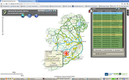
If you’re anything like me the thoughts of producing a distribution map to illustrate a report or to test a new idea will fill you with dread at the thought of the hours of tedious work involved. I’ve often wished that someone would produce a software package that would make the whole task easier. Now the National Monuments Service has come to the rescue with the new National Monuments Database Map Viewer which is available at http://www.archaeology.ie/.

The Map Viewer can be used to create distribution maps of any monument site classification as long as there are less than 999 records and you don’t need a degree in a computer programming language to do it.

The monument class dropdown menu

The trick is in the use of the new database Query window that sites at the top right of the new Database screen. Maps can be created on a national level or a smaller area such as a county or townland can be selected by choosing a county, townland or town from one of the the drop-down menus in the query window.

Selection of Motte and Bailey Castles.

Once the area is chosen, go to the class drop-down menu and select the type of monument you want to map. In the example illustrated here I’ve selected Castle-motte and bailey because there are fewer than 999 of them. If you want to map a class like Ringfort with thousands of examples you’ll have to work at the county or townland level.

Click search and it generates the map.


Now simply click the search button and the Map Viewer automatically generates the distribution map for you on screen. Above is the distribution map of Motte and Bailey Castles!

Hover over a distribution point to get its details.

[/captionIf you hover over the distribution point with the cursor it will bring up a window with information on the site and highlight the site on the dropdown list in the query window, great. Currently there’s no way to output the distribution map to a printer or graphics package so you’ll have to resort to the trusty screen grab. All in all this is a huge leap forward in the ability to use the data held in the National Monuments Database. Thanks are due to everyone involved in making this available, especially Paul Walsh.

Geographica Blog

Geographica have an excellent follow-up to this post on

Opening Data with Google Fusion Tables


Cite this blog as:

Mount, C. Creating distribution maps in the Irish National Monuments Map Viewer. The Charles Mount Blog, July 5, 2011. http://charles-mount.ie/wp/?p=163

The archaeologist who designed the monument to Ireland’s golden age

The O'Connell Memorial at Glasnevin

After reading Peter Carvill’s comments on the “Monuments and created and appropriated continuity” post about the O’Connoll memorial at Glasnevin, I decided to have another look around the site. Glasnevin is an excellent example of a created continuity. The site today appears to have a vestige of antiquity about, but is in fact an invention of the mid-nineteenth century.

As part of the project of Irish national development the early archaeologist George Petrie was invited in 1851 to design a monument for the Irish nationalist leader Daniel O’Connell. Petrie, regarded by some as the founding father of Irish archaeology, had been head of the Placenames and Antiquities section of the Irish Ordnance Survey and President of the Royal Hibernian Academy. In 1833 he was awarded a gold medal by the Royal Irish Academy for his essay Origin and Uses of the Round Towers of Ireland that proved beyond challenge that the most prominent monuments in the Irish landscape, the Round Towers, were not built by invading Danes but by the Irish of the Early Christian era. In the following years the Round Tower had become one of primary symbols of Irish national resurgence.

The site chosen for the monument to O’Connell was not a historical site like the Hill of Tara, with its existing history and mythology, but the site of the new catholic cemetery established in 1832 under O’Connell’s patronage in the Dublin suburb of Glasnevin. The Committee of Glasnevin Cemetery, whose members were largely drawn from O’Connell’s Catholic Association established in 1823, had appealed to the O’Connell family for the body and had then paid for it to be returned from Italy where he had died. With O’Connell’s remains at Glasnevin the Committee planned to build a tomb and monument on the site. Although this was a new site the monument still had to refer back to what was perceived as the Irish golden age and Petrie was chosen as the acknowledged expert. His vision was to recreate the core structures of an Early Christian monastic site, the Round Tower, Church and High Cross. O’Connell’s tomb was placed in the crypt, which took the form of a circular barrow or burial mound enclosed by a ditch that gave access to the crypt beneath. Atop the barrow a massive 51m Round Tower was constructed, the largest ever built in Ireland. However, Petrie’s original plan was not fully realised as the whole plan was not completed. The mortuary chapel was not built until 1870 and the High Cross was never completed.

The result was an extraordinary monument and statement of national resurgance. O’Connell’s monument is a good example of the creation of continuity. The national icon O’Connell was not memorialised on an old site or at an old monument with its own history and mythology but at a completely new site where a new history and mythology were being created. Yet the form of the monument still looked back to and improved on an idealised golden age. Here at Glasnevin a new mythology could be developed by a new rising elite freed from the shackles of history but looking back to and claiming continuity with an imagined golden age. Here also one of the founding fathers of Irish archaeology found a role as the architect of the link to Ireland’s golden age.

Cite this post as:

Mount, C. The archaeologist who designed the monument to Ireland’s golden age. The Charles Mount Blog, June 29, 2011. http://charles-mount.ie/wp/?p=165

The four ways we know about the past

An example of explicit knowledge communicated across space and time, a letter from Amarna in Akkadian Cuneiform.


There are two primary types of knowledge: explicit knowledge and tacit knowledge. Explicit knowledge is learning that can be expressed clearly in signs, words or numbers. Explicit knowledge, because it can be codified and stored in the form of books, computer records and archives, can be handed on from person to person without direct interpersonal communication. Explicit knowledge can also be communicated and shared across both space and time in the form of broadcasts, letters, emails, books and records. Some of these records, like Egyptian hieroglyphics or Sumerian Cuneiform, are very old and provide important insights into the past. Explicit knowledge is also be held by groups of people, for example, in the form of language or the knowledge of the rules of law held by lawyers. In these instances an individual may hold part or most of this knowledge, but the entire sum of this knowledge is only held by the group.
 
The concept of tacit knowledge was defined by Michael Polanyi as learning that is gained through direct experience and remains intangible. Tacit knowledge is often difficult or impossible to communicate through language or other coded processes and is difficult to successfully communicate across space and time. As tacit knowledge is gained through experience it tends to be specific to an individual and a particular context, and consists of insights and intuitions as well as technical abilities. Tacit knowledge held by an individual can be manifested as a set of complex skills. For example, an individual may be able to ride a bicycle but may have no explicit idea of how they do this; they are unable to explain the process. Learning how to ride consists of an iterative process of trial and error as one learns the complexities of coordination and balance. Most skills that require comprehension of information which is too complex to be verbalised, such as recognising subtle archaeological features, the ability to see and explain patterns in raw data or the ability to overtake on a race-circuit rely on tacit knowledge gained through experience.
 
Tacit knowledge is also held collectively by a group or community of practice. Groups hold common views of the world or belief systems that incorporate tacit assumptions. Within the research community professional groups, like archaeologists and historians, form informal social networks or communities of practice that share tacit assumptions about their fields of research and the wider world. As these tacit views mould the way in which group members view the world, the tacit knowledge of the group will influence the nature of the knowledge gained. For example, if we use Thomas Kuhn’s concept of the scientific paradigm to characterise tacit group knowledge, then the knowledge gained by the individual member will be influenced by and will often form part of and support the general tacit assumptions of the paradigm. In instances where the tacit assumptions of the group continued to be held in the face of overwhelming contradictory evidence these paradigms are referred to as group think.

The objective of archaeology and history is to increase our knowledge of the past through the study of the material remains and documents left behind by people. As archaeologists and historians we know things about the past in four different ways. We have both explicit and tacit knowledge about the past, we have knowledge as individuals and we share knowledge as part of a group or community of practice.

The realisation that we have knowledge in four ways, as individuals, as members of groups and both explicitly and tacitly is important for the development of innovative thinking. It can often be an intellectual and social challenge for the individual to think outside of the tacit assumptions held by the group of which they are a member. As a result important new knowledge discoveries are often made by individuals operating outside of groups. In order to develop new insights we need to understand how our knowledge of the past has been formed, not only though explicit discourse, but through our tacit experiences and the tacit assumptions of the groups to which we belong.


Mount, C. The four ways we know about the past. The Charles Mount Blog, June 21, 2011.  http://charles-mount.ie/wp/?p=155

 
Further reading
Michael Polanyi 1966. The Tacit Dimension. Routledge and Keegan Paul.
Charles Mount 2004 Explicit data and tacit knowledge, exploring the dimensions of archaeological knowledge, in H. Roche et al. (Ed) From Megaliths to Metals. Oxbow Books
Thomas Kuhn 1996 The structure of Scientific Revolutions. University of Chicago Press.


Cite this post as: